Professor Emerita Karen Barzman, “The Origins of Mapping in Information Technology – Topographical Drawings in Venice’s Early Modern Archive”
Department of Art History Colloquium
November 1, 2024
4:00 PM - 6:00 PM America/Chicago
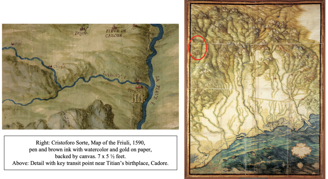
In the mid-fifteenth century, the Republic of Venice undertook a long-term project of collecting, recording, and delivering data (quantitative and qualitative) of near and distant lands within its territories, to better manage its transregional state. Carried out by different magistracies, the data were collected at different scales but almost always recorded on paper, combining location-specific text like place-names in precise geographic alignment with topography visualized below in pen-&-ink drawings and watercolor. The lecture explains how these unprecedented forms of cultural production revolutionized information technology. Initially thriving in proximity to adjacent practices like landscape painting, they may also be linked with things we take for granted in screen culture, from user-friendly Google Maps to GIS, which permits trained users to add to a geospatial database as well as query it. Also originating in government initiatives, these apps and platforms are little more, I would argue, than digital analogues to analog technology first conceived and implemented in early modern Venice.
Karen-edis Barzman is Professor Emerita of Art History at Binghamton University. She currently resides in Chicago, where she teaches part-time at DePaul University and is also a Scholar in Residence at the Newberry Library. Her fields include early modern Italian studies, urban history, the history of cartography, and digital humanities.
Please email uicarthistory@uic.edu for the Zoom link.
Date posted
Oct 16, 2024
Date updated
Oct 17, 2024