Rodrigo Solinis-Casparius, “The Shape of the City and the Social Roles of Ancient Roads”
UIC Art History Colloquium
April 9, 2021
4:00 PM - 6:00 PM
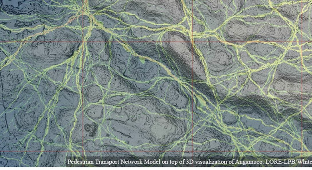
People move. When we do, we shape our cities by creating networks of movement behaviors in the form of trails, roads and pathways. This is true on every urban settlement in our planet. Thus, ancient settlements and their ancient roads are essential to understand the roles that movement plays in the spatial configuration of a city and the daily life of its residents. Here, I present a novel approach to identify and study >1,000-year-old pathways using remote sensing (lidar), computational analyses, and traditional archaeological work like survey and excavation in a massive Mesoamerican urban center in Western Mexico.
Rodrigo Solinis-Casparius is a Postdoctoral Research Associate at the Anthropology Department of University of Illinois at Chicago. His research focuses on the social implications in the development of urban layout of ancient cities. Most recently, he centered in the road network of the prehispanic city of Angamuco (250-1530 CE), located in Michoacán, MX. He integrates spatial analysis (GIS and geographic network analysis), image analysis, and remote sensing (lidar) to identify ancient roads in heavily vegetated locations and to study pedestrian traffic patterns, urbanization development, and general movement behaviors of ancient societies. His research provides insight into how such cities emerge, develop, were inhabited, and experienced by their residents, and the roles that roads played during these processes.
For a Zoom link, please email arthistory@uic.edu.
Date posted
Mar 29, 2021
Date updated
Mar 29, 2021